
Always stay up to date!
The GPSoverIP newsletter keeps you up to date on the latest in telematics:
Whether it’s new products, new features, or upcoming events, you’ll receive our news via email.
The newsletter is published several times a year, depending on current topics.
Newsletter-Archiv
GPSoverIP Newsletter 01/2026
Fleet Management Under Control
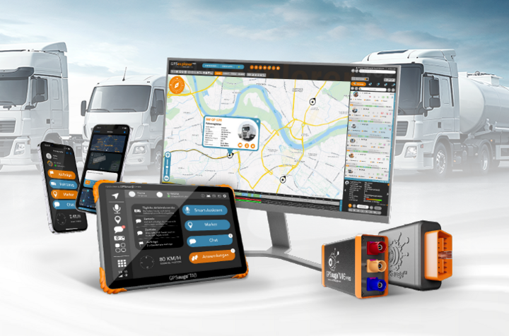
More vehicles, more documentation, less time.
2026 demands one thing above all else from scheduling and fleet management: clarity.
If you want to work in a structured way, you need a comprehensive overview of vehicles, drivers, and processes—not even more coordination loops.
In this newsletter, we’ll show you which features, integrations, and industry solutions are truly relevant right now—and where you can immediately lighten your workload.
Enjoy reading, and best regards from Schweinfurt
Your GPSoverIP Team
P.S.: If you tell us your fleet size and industry, we’ll immediately suggest a suitable setup (platform, app, hardware, add-ons).
Environmental Protection and Safety Grant Program (De minimis)
Plan ahead
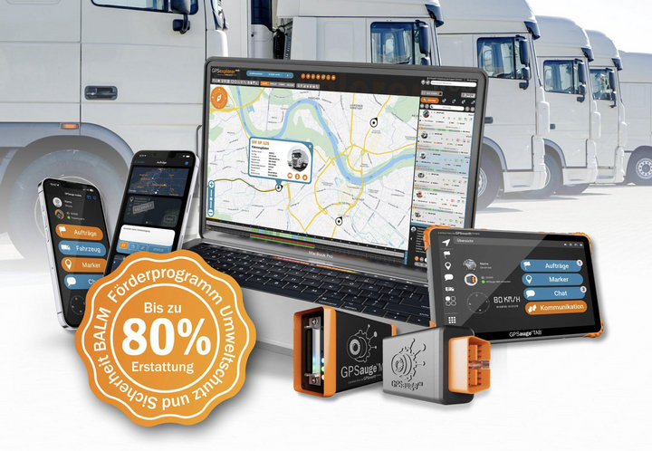
Environmental Protection and Safety Initiative 2026
Find out more now and plan ahead
The well-known De Minimis grant program, officially renamed “Environmental Protection and Safety” in 2024, is entering a new round. During the 2026 funding period, companies in the motor carrier industry can once again apply for grants for measures aimed at improving environmental protection, safety, and efficiency.
Investments eligible for funding through the BALM grant program: telematics systems (hardware, software, and data).
Current Status of the 2026
Environmental Protection and Safety Funding Program, November 14, 2025: After a reconciliation session lasting over 15 hours, the Budget Committee approved the federal budget for 2026.
Funding available: 261.9 million euros
. Sufficient for: Up to 130,950 trucks (assuming full payment of 2,000 euros per vehicle)
Key Dates at a Glance
December 1, 2025
: Cutoff date for vehicle ownership of heavy-duty commercial vehicles—by this date, at least one truck must be registered to your company!
January 14, 2026: Applications
open for the Continuing Education and Training subsidy programs
April 14, 2026
: Applications open for the Environmental Protection and Safety/De Minimis funding program—be sure to apply on time!
August 31, 2026
: Last possible date for submitting applications—don’t wait too long!
Important: Applications are processed on a first-come, first-served basis! Once the funding pool is exhausted, no further grant notifications will be issued—even if you would otherwise be eligible.
Risk of Errors in Applications: Errors in the Environmental Protection and Safety application will result in rejection. Processing may take several weeks. If you resubmit a corrected application, the later submission date will apply—with the risk that the funding pool may already be exhausted by then.
Winter Road Maintenance Telematics
Specially Designed for Municipal Maintenance Depots and Local Governments
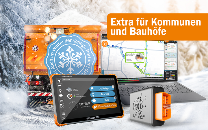
Winter Road Maintenance 2026: Document Operations, Verify Routes, Maintain an Overview
Winter road maintenance is the same routine every year: coordinating operations, accurately documenting routes, and—when in doubt—being able to quickly prove what happened, when, and where. Our winter road maintenance telematics system provides you with the perfect solution for exactly that.
What you see in real time—automatically recorded
- Live tracking and operation overview (desktop & mobile)
- Lane/cleared route, including work progress
- Spreading data: spreading width, material, spreading quantities, and relevant parameters—automatically, without manual entry
Planning & Control Instead of “Radio and Gut Feel”
- Operation planning and route planning
- Geofencing (e.g., districts, sensitive areas, verification zones)
- Work instructions sent directly to drivers/teams (including feedback)
Compatibility that makes all the difference in practice
- Our solution is compatible with all leading spreader manufacturers. You aren’t locked into a single provider.
Quick to get up and running—even with subcontractors
- Plug-and-play: GPSauge OBD with QuickConnect connection—ready for use in 5–10 minutes in many cases
- Ideal for integrating subcontractors (fast rollout, clear documentation within the same system)
The entire system runs on our GPS-Explorer platform—using GPSauge OBD/MI6, GPSauge TAB, and the driver app, depending on the vehicle.
Why GPSoverIP: We’re not just “fleet management software that also handles winter operations”—our focus is specifically on winter service telematics. And you have dedicated contacts. When things get tough in the field, you get real solutions, not boilerplate responses.
2G Shutdown Is Coming
Check now to see which telematics devices are affected

Starting in 2028, things will get serious for older telematics hardware. Anyone still using 2G will lose their connection.
The 3G network is already a thing of the past. By 2028 at the latest, 2G will also be phased out in Germany. For many modern applications, this is no longer an issue—but for older telematics devices, it certainly is.
After all, without a cellular network, there’s no data transfer.
And without data transfer, there’s no location tracking, no remote access, and no automatic data collection.
This primarily affects older GPS trackers and telematics units that operate exclusively on 2G or 3G. After the shutdown, these devices will either be completely offline or only partially functional.
What this means in practice
- No real-time tracking
- No access to driving data
- No remote download
- No reliable data transmission
This can quickly become a critical issue, especially for freight forwarders, construction companies, and municipal fleets—particularly when processes are designed around automated workflows.
Who is affected?
Not every fleet is automatically affected. Many customers are already using LTE- or 5G-capable hardware. Devices such as the GPSauge MI6 Pro or GPSauge OBD are 4G/5G-ready and thus future-proof.
The key question is: Which generation of devices is currently in use?
Check now instead of reacting later
Even though 2028 may still seem a ways off—it’s easier to plan hardware upgrades during normal operations than under time pressure.
That’s why we’re actively informing existing customers about affected devices and providing support for the technical transition—including the buyback of older hardware.
Those who act now not only ensure the continued functionality of their fleet but also take advantage of the opportunity for a technical update with tangible benefits such as more stable data transmission, greater network coverage, and expanded analytics capabilities.
If you have any questions about your device fleet or the upgrade process, our sales team is here to help.
Interface Integration: ET360
Industry Spotlight: Towing and Roadside Assistance
Third-Party Integration: GPSauge Telematics Now Available in ET360
GPSoverIP’s telematics solutions are now integrated into the ET360 industry solution for roadside assistance, towing, and transportation companies. This allows users to access vehicle data directly within their familiar ET360 work environment.
ET360 is one of the leading software solutions in this segment and maps key operational processes—from order acceptance through dispatch and mission control to execution in the driver’s workflow. Thanks to the integration of GPSauge telematics, a comprehensive fleet overview is now available, allowing vehicle locations and movements to be directly incorporated into daily dispatch planning.
This integration expands existing functionality by establishing a direct link between telematics data and operational workflows, while also laying the groundwork for future expansion phases and functional enhancements.
Interface integrations have always been part of GPSoverIP’s open system approach. In addition to providing documented APIs, GPSoverIP supports various integration methods, ranging from HLD drivers to the integration of external software solutions and third-party telematics systems.
Companies that wish to expand their existing software landscape with telematics functions or implement their own integrations can contact the GPSoverIP team at any time. Further information on available interfaces can be found on the GPSoverIP API page.
AI Chat Feature
New Feature in GPS Explorer
Find Answers Right in the System
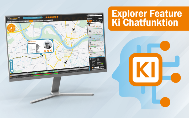
In everyday life, questions rarely arise when you’re sitting at your desk with plenty of time to spare—they tend to pop up precisely when you need a quick answer. That’s why a chat feature is being integrated into GPS Explorer: You enter your question and receive relevant answers directly within the system. This saves search time, reduces follow-up inquiries, and helps resolve common support issues more quickly. The feature is currently running in a test environment and will be gradually rolled out to the Explorer.
What’s it good for?
- Find your way around faster: Get immediate answers to questions about features, menu items, or workflows.
- Fewer interruptions in day-to-day operations: Dispatch and fleet management receive immediate answers instead of having to make internal inquiries or create support tickets.
- Faster assistance with support issues: Standard questions are answered directly—giving our support team more time to address complex issues.
Here’s
how it works
- Enter your question in Explorer (e.g., “How do I find the report on …?”)
- Receive the appropriate answer (steps, instructions, or a link to the relevant section, if applicable)
- If necessary: Forward to support/submit a request
Real-world
examples
- “Where can I find the report for …?”
- “How do I change the status / what does status X mean?”
- “What steps do I need to take for …?”
- “Why can’t I see …?” (Permissions/roles are a classic example)
Status & Outlook
The chat feature is currently running in a test environment. The goal is to integrate it into GPS Explorer through a phased rollout to ensure that its operation and responses are truly suitable for everyday use.
FAQs - Frequently Asked Questions
Is this a support chat with staff members?
No, it’s an integrated chat feature that provides answers to common questions and helps users navigate the system.
Can I also use it to submit support requests?
The current focus is on providing quick help within the system.
What kinds of questions does the tool answer?
Common questions about features, workflows, and frequent support topics within GPS Explorer.
What if the answer isn’t enough?
In that case, you can still use the traditional support channels. The chat is designed to help resolve simple issues more quickly.
Violation Report
New in GPS Explorer
Expanded Considerations for Violations of Driving and Rest Periods
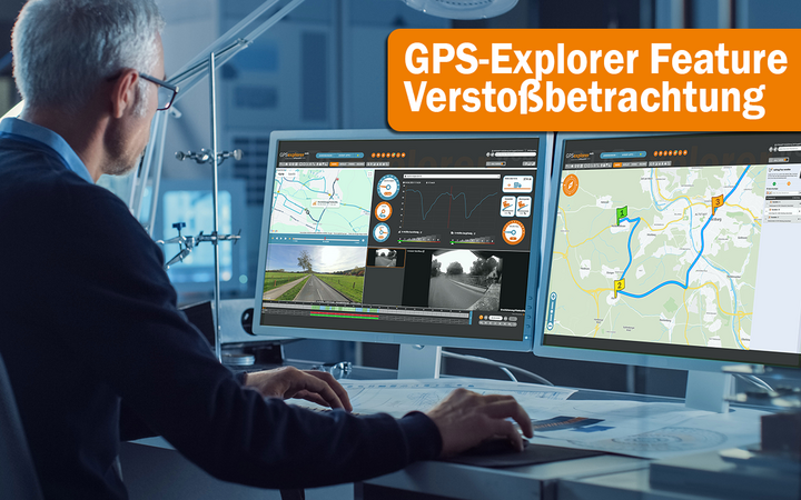
Functional enhancements have been implemented in the violation analysis module within GPS Explorer, which further refine the analysis of driver-related events in the context of statutory driving and rest period regulations.
In particular, the structural presentation of the violation reports has been enhanced. In addition to the assessment in accordance with the requirements of Regulation (EC) No. 561/2006 and the German Driver Personnel Ordinance (FPersV), additional driving-related information is now displayed directly within the evaluation context. This includes, among other things, the integration of speed-related events within the violation report, which eliminates the need to examine individual evaluations separately and provides a consistent overall overview.
The generated printout has also been adapted accordingly and supplemented with additional details. The reports thus provide a technically well-structured foundation for driver training, internal compliance processes, and documentation and verification requirements with regard to auditing bodies.
These enhancements further develop the existing violation analysis in a targeted manner and enable an even more transparent classification of driver-related events in day-to-day fleet operations.
GPSoverIP – data-driven support for compliant vehicle deployment.
Diagnose Trouble Codes (DTC)
New in GPS Explorer
Advanced Vehicle Diagnostics: Early Detection of Technical Issues Through DTC and Fault Code Analysis
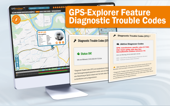
With a recent device update, GPSoverIP has expanded its telematics-based vehicle analysis to include a significantly more in-depth diagnostic assessment based on Diagnostic Trouble Codes (DTC) and extended fault codes from various vehicle systems.
This expansion enables the collection and structured processing of additional telemetry data points from the vehicles. In addition to traditional diagnostic information from the automotive sector—such as tire pressure, oil level, engine temperature, or lighting systems—the system can now also process more detailed error and status messages, such as those transmitted as fault codes in public transit or specialty vehicle applications.
At the core of the extension is a comprehensive integration database in which measured values, diagnostic parameters, and coded error messages are linked together. The values are not displayed in isolation but in conjunction with tabular reference structures that enable systematic evaluation through analytical algorithms. On this basis, technical anomalies can be detected at an early stage—often even before an actual failure or visible malfunction occurs during vehicle operation.
Within the vehicle overview, detected anomalies can be displayed directly via an expanded overlay. This provides dispatchers and fleet managers with an early assessment of potential fault situations, allowing them to prepare targeted measures rather than having to react only after acute malfunctions occur.
The analysis is not limited exclusively to traditional Diagnostic Trouble Codes. By incorporating expanded fault-code structures, diagnostic-like status messages from other system environments are also integrated, resulting in significantly broader technical transparency regarding the vehicle’s condition.
In addition to the diagnostic overview, there is an advanced repair module that can be optionally activated via a special license. This module enables fleet-specific processing of diagnostic information and supports maintenance and repair processes through structured recommendations for action and analyses. Due to the individual configuration, activation is project-specific.
However, the new diagnostic extension itself already offers considerable added value:
Early fault detection can reduce downtime, lower maintenance costs, and prevent unplanned operational interruptions.
jammer.net Integration
The Digital Logbook—Now Available Directly in GPS Explorer
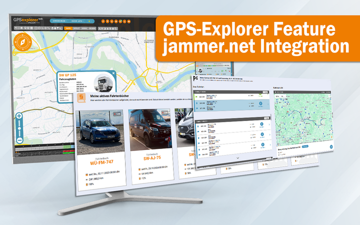
jammer.net Logbook Feature in GPS Explorer
The jammer.net logbook feature has been further expanded in GPS-Explorer and integrated into the existing work environment.
A logbook can now be created and started directly in GPS-Explorer. This allows users to begin keeping a logbook immediately within the vehicle management module, making it easier to integrate into daily workflows.
In this context, please note once again: The previous logbook solution remains available and was already renamed the “Start/Stop Log” as part of an earlier update. This module continues to be aimed at users who wish to utilize a more in-depth, telemetry-based vehicle analysis, while jammer.net is specifically designed to meet the requirements of a tax-compliant logbook in accordance with the 1% rule.
This means that both variants remain available in parallel and can be used flexibly depending on the application.
GPSoverIP – Logbook solutions tailored to each specific application.
Tacho-Remote-Download
Included as standard in fleet management
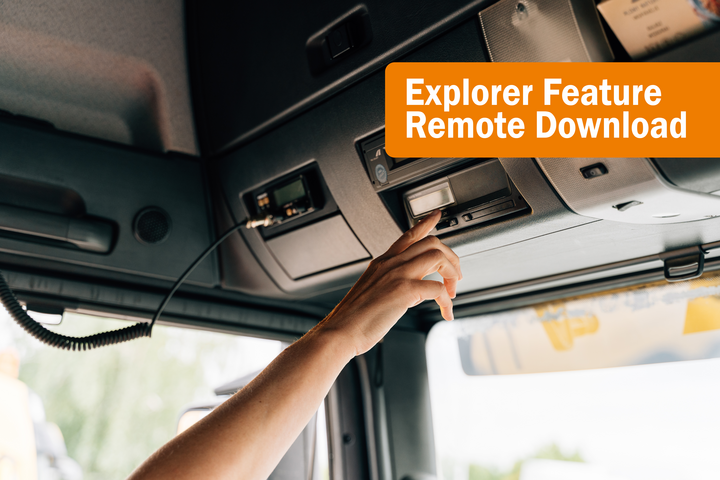
Tacho Remote Download in GPS Explorer: Driver Card & Mass Storage Automatically—No Manual Reading Required
Tachograph data is mandatory. However, manually reading the data takes up unnecessary time and creates friction every time. With the Tachograph Remote Download feature, you can download driver cards and mass storage devices centrally in GPS-Explorer: manually with a single click or automatically according to a schedule. This reduces trips to the repair shop, prevents deadline stress, and makes the data truly usable in everyday operations.
Common everyday problems
- “The driver is currently on the road—the data download gets postponed again.”
- “Keeping track of deadlines is a mini-project every single time.”
- “The data is somewhere, but no one uses it for planning or scheduling.”
What remote download actually delivers
- No vehicle downtime just for data retrieval
- Deadlines under control (e.g., 28/92 days—depending on specifications/setup)
- Centralized, traceable storage instead of file chaos
- Predictability for scheduling and fleet management (who is available when, what’s still possible)
How it works
In GPS Explorer, downloads can be performed in two ways:
- Manually with a click (if you need it right away)
- Automated according to a schedule (so deadlines don’t “slip through the cracks”)
The data is stored centrally and is available for analysis and overviews.
Who stands to benefit the most?
- Freight forwarders and transportation logistics (traditional)
- Fleets with many drivers or rotating crews
- Companies that want to minimize workshop and downtime issues
- Teams that prefer to handle documentation thoroughly rather than “on demand”
FAQs – Frequently Asked Questions
Is this an add-on module?
No, remote download is included as standard in GPS-Explorer’s fleet management system.
Does the vehicle need anything specific for this?
Yes, the requirements vary depending on the vehicle’s equipment and hardware. We’ll quickly check and let you know if everything is in order or what’s missing.
Can this run automatically?
Yes, the goal is: less manual follow-up, more routine.
GPS Explorer: Usability and Design Update in the Works

The GPS Explorer is currently undergoing further development.
GPSoverIP’s development department is currently working on a comprehensive usability and design update intended to make the system even clearer and more intuitive to use in the future.
Over many years, the portal has developed a wide range of features related to telematics, analytics, statistics, automation, and programs. Step by step, GPS Explorer has been expanded and has evolved into a powerful tool for digital fleet management.
However, this growing range of features has also increased the system’s complexity. Many options are available—but they aren’t always immediately apparent.
This is exactly where the upcoming update comes in.
The goal is to structure functions, reports, statistics, and programs more clearly and make them easier to find. This should make the system’s capabilities even more apparent and easier to use in the future.
The first steps in this direction were already taken with the last major update, including the integration of AI assistants. The upcoming update builds on this and further refines the user experience.
Submit Feedback Now
You can already submit suggestions or requests. The development team welcomes feedback from real-world use.
📞 +49 9721 79 69 73 63
✉️ info@gpsoverip.de
Keyword: Explorer
More information about the update will follow shortly.
GPSoverIP Named “Company of the Year 2026”
A study by Deutschland Test and ServiceValue evaluates approximately 16,500 companies

GPSoverIP Named “Company of the Year 2026”
In a recent market study conducted by Deutschland Test in cooperation with ServiceValue, GPSoverIP was named “Company of the Year 2026” in the Industry & Specialty Software Providers category.
The study is based on a cross-industry analysis of approximately 16,500 companies. Several million publicly available online mentions were evaluated. The assessment took into account criteria such as value for money, customer trust, quality, and service, among others. Within its own category, GPSoverIP achieved an above-average overall score.
Strategic Course-Setting in 2025
The award comes at a time of targeted strategic development. As early as 2025, GPSoverIP had already set a clear strategic course to consistently align telematics solutions with real-world use cases in vehicle and fleet management. The focus was on sustainable investments in technology, digital usage models, and the further development of future-proof fleet telematics for various user groups.
“Despite global challenges, our solid foundation remains the key to our success,” says André Jurleit, Managing Director of GPSoverIP. “We’re delighted to receive this award because it’s based on independent consumer reviews. It confirms our focus on user-friendly, field-tested telematics solutions and reliable customer service.”
Product and usage concepts focused on everyday practicality
A key milestone was the launch of the GPSauge Suite app. It serves as the gateway to the GPSoverIP product ecosystem, enables quick setup, and acts as a central platform for existing and future digital services. Complex telematics functions are thus presented in an easy-to-understand way, made available on mobile devices, and can be used at any time in daily operations.
In addition, jammer.net was introduced as a new usage concept that fundamentally simplifies the transition to vehicle digitization. The system starts as a ready-to-use, tax-compliant trip log and can be gradually expanded into a full-fledged professional telematics solution for fleets as needs grow. This scalable model lowers the barriers to entry for vehicle telematics and opens up new target groups.
Innovation in Drivers’ Daily Routines and Organizational Operations
New features have also been specifically introduced in operational use. With the AI-powered voice assistant “Hey, GPSauge,” true voice control has been integrated into the GPSauge TAB driver display. Navigation, order processing, and communication can be controlled via voice commands—hands-free, safely, and efficiently. Telematics thus becomes not only more powerful in the driver’s daily routine but also immediately tangible.
At the same time, GPSoverIP has further developed its internal structures. Flexible work models, modern development processes, and the targeted use of proprietary AI technologies increase agility, automation, and the pace of innovation, delivering direct added value for customers and partners.
Confirmation of a Clear Course
Being named Company of the Year 2026 thus confirms exactly what GPSoverIP had already openly communicated in advance: foresight, sustainable investments in technology, and a consistent focus on tangible benefits for users.
The preparations and implementations carried out in 2025 are now visibly bearing fruit. At the same time, the award underscores GPSoverIP’s commitment to continuing to play an active role in the further development of digital solutions for mobility, vehicle fleet, and fleet management.
The complete results of the study are published online at deutschlandtest.de. Further information on the methodology can be found at ServiceValue.
GermanyTest Company of the Year
TOPLIST: Telematics 2026
Proven Excellence in the Telematics Market
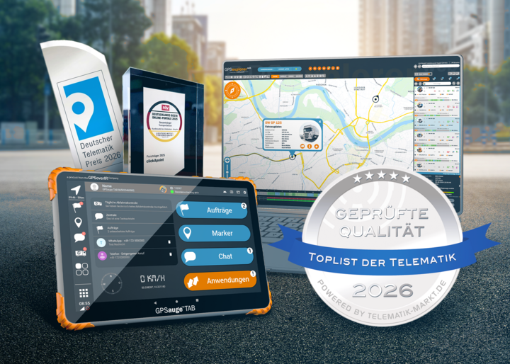
GPSoverIP Qualifies Again: Telematics TOPLIST 2026
The annual review for the Telematik 2026 TOPLIST has been completed, and GPSoverIP has once again been included.
The TOPLIST is an independent provider directory compiled by the editorial team at Telematik-Markt.de. Only verified, high-performing companies in the industry are listed.
Especially in a market with a high concentration of providers, the TOPLIST offers users and decision-makers reliable guidance. The annual review by independent experts ensures that products and services remain competitive and up to date.
For freight forwarders and transportation companies that operate daily under time constraints, cost pressures, and regulatory requirements, this transparency provides an additional point of reference when selecting providers. It builds trust in systems that must function reliably in day-to-day operations.
With this renewed certification, we are authorized to display the TOPLIST seal again in 2026. This underscores our consistent performance and provides greater visibility in an environment where customers need reliable guidance.