
Telemetry Data: Collection & Analysis
Nothing escapes the GPSauge—track all your fleet’s data, from fuel consumption to auxiliary power units
The transmission of telemetry data captures crucial information that serves as the basis for analyses and cost savings, for example regarding fuel consumption and wear and tear. In addition, the flexible telemetry data collection via GPSoverIP enables the transmission of all data relevant to your analysis. This can include, for example, the amount of material spread during winter road maintenance, the volume delivered by a tanker truck, or the activity of a specific power take-off unit.
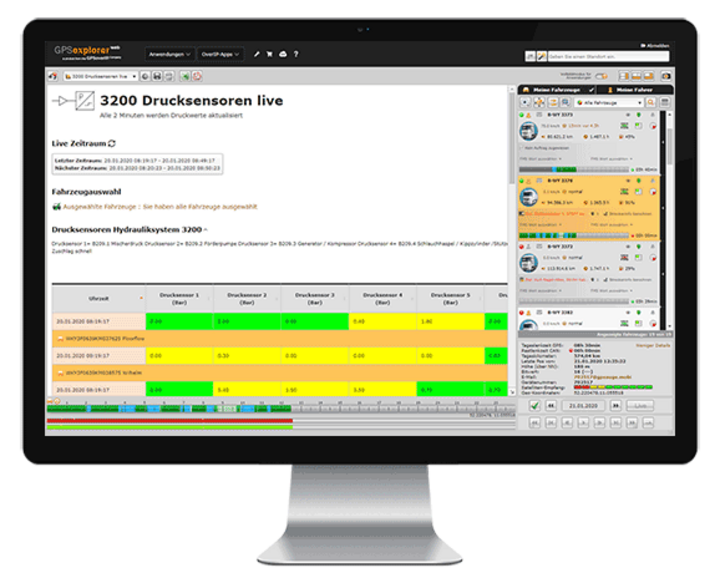
In GPS-Explorer web, a web-based fleet management tool, this collected telemetry data is visualized, analyzed in tabular form, and fully documented. Customization of the data is made possible by numerous integrated protocols, a wide range of communication options, and inductive connectivity. You also benefit from flexibility in data analysis, including features such as the wildcard function and the lane editor. This allows you to calculate and document relevant values according to your requirements.
The visual display also provides comprehensive insights: How wide was the spread? What was spread? What was the temperature at what time? How long was the auxiliary drive running? Taximeter on/off? Passenger seat free/occupied? etc.


Your Benefits
- Transmission of all required telemetry data
- Every second—or when there's a change … or … or …
- Flexible reporting in visual and tabular formats
- A wide variety of ways to get in touch
- Quick and easy to set up
- Adjustable Alarm Functions
- Threshold monitoring, etc.
- Suitable for all vehicle classes and types (trucks, passenger cars, light commercial vehicles, buses, etc.)
Ausschnitt aus dem GPS-Explorer
Der GPS-Explorer ist das Flottenmanagement-Portal das zum Lieferumfang eines jeden GPSauge gehört - mit allen Funktionen on-board, ohne Einschränkungen oder kostenpflichtige Extra-Pakete.
Route/Route Editor
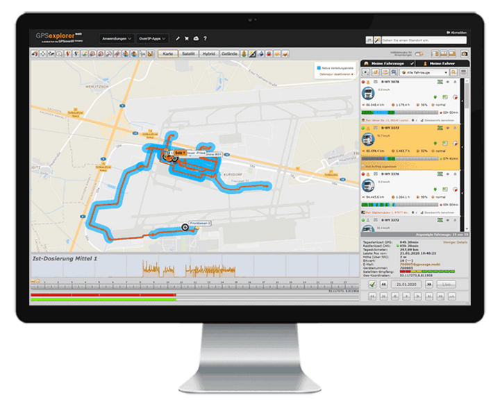
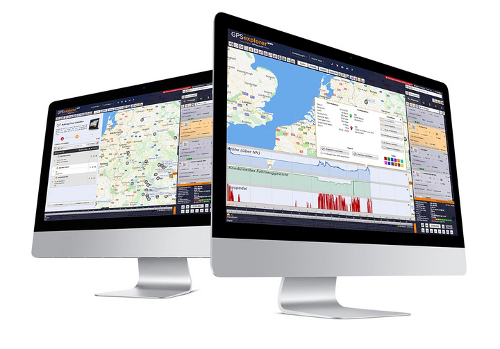
The route function in GPS Explorer (a browser-based web portal) displays the route traveled with all details in tabular and visual form with just one click. By selecting additional data in the Track Editor (such as loaded/unloaded, accelerator pedal position, auxiliary drive, speed, working widths of special attachments, etc.), you can customize the display to meet your specific needs.
A replay function allows you to visualize the entire driving situation for the selected time window, including the selected additional values. You can compare and analyze driving paths from different vehicles to, for example, optimize a route or visually display areas that have been worked on (keywords: winter road maintenance, agriculture, street sweeper, etc.).
Life is live
The tracking and data transmission enabled by the GPSauge are in real time. This means that the user at the computer has access to all information the moment an event occurs.
This includes data such as position and speed, load status, vehicle telemetry data, driving times, as well as information from signal sources such as taximeters, temperature sensors, and special equipment—such as winter service vehicles—and much more.
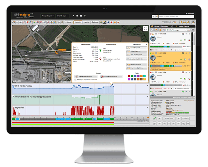
Status Indication / Additional Signal Transmission / FMS, CAN, MVB, ISO-Bus, RS232, Analog/Digital Signals/Connections
In addition to data transmission from wired sources such as FMS, CAN, MVB, ISO-Bus, RS232, and analog/digital signals/connections, the user can also retrieve information from wireless signal sources such as BLE and NFC and display and analyze the values in the GPS Explorer (browser-based web portal).
Joker
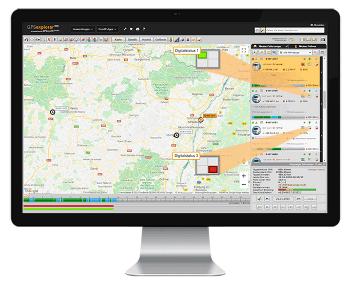
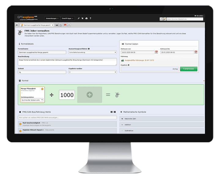
The Joker feature in GPS Explorer (a browser-based web portal) uses the recorded telemetry data to calculate any value you need (e.g., the conversion factor from spray width to application rate). Using predefined calculation formulas, you can quickly and easily perform additional value calculations or conversions—in addition to your existing values.
The newly calculated value can then be included as a “Joker” field in tabular and visual analyses and statistics.
Report Configurator
In GPS Explorer (a browser-based web portal), you can easily create custom reports on your own. Design reports in your corporate identity and add the necessary elements—such as tables, charts, vehicle information, indicators, and maps—to your calculations, tailored to your company’s specific needs and requirements.
Examine situations with pinpoint accuracy and without restrictions, tailored to your needs—daily, weekly, monthly, or at custom time intervals—even down to the second!
If desired, you can also share the custom report with third parties via a web-based authorization system.

The associated telematics portal
The GPS Explorer (browser-based web portal) is included with every GPSaugen (telematics unit). It is a powerful application for managing fleets of any size.
It doesn’t matter whether you need to manage just one vehicle or thousands.
Try it now with no obligation

Test the most professional telematics solution extensively, with no obligation and at no cost, and see for yourself why it’s the most powerful telematics system.
Simply provide your contact information, and your account manager will assist you from product selection to installation in your vehicle—he’ll take care of everything and be available to answer any questions you may have throughout the entire trial period.
- Free Trial
- based on your requirements
- tailored to your company’s structure
- Your personal account manager will guide you through the process

Everything at a glance—even on the go
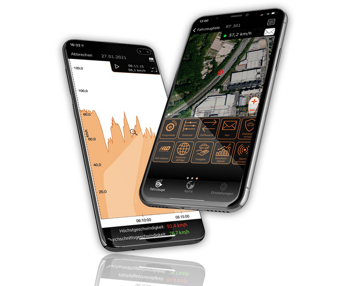
Manage your fleet with GPS-Explorer Mobile: fleet management even when you're on the go.
Which vehicle in your fleet is closest to a destination address?
Where are my vehicles?
What is the current temperature in the cargo area?