
Object Recognition / Surrounding Infrastructure
Efficient Object Detection for Enhanced Transparency
With object detection, you can easily expand your telematics system to include monitoring of the surrounding infrastructure by using accessories. Bluetooth tags communicate via the BLE or BLR standard with the GPS sensors installed in the tractor units—whether from your own fleet or anonymously from other nearby vehicles.
The current position of the object (the BLE tag) is transmitted directly to the GPS Explorer—a web-based fleet management portal—with second-by-second accuracy. Depending on the type of tags, additional status information—such as light and temperature readings—can also be transmitted and analyzed. This enables features like alert notifications that inform you, for example, when the tailgate is opened.
Object recognition allows you to continuously monitor the location and status of surrounding objects such as trailers, attachments, containers, and more. This takes the form of “passive tracking,” whereby the position of the TAGs is visually displayed on the map and/or in clear tables within the GPS-Explorer web interface. The recorded position data can, for example, be sent as destinations to GPSaugen for navigation. Object recognition also offers additional related features to increase transparency and control over your infrastructure.


Your Benefits
- "passive tracking"
- Location data for: attachments, containers, swap bodies, trailers, machinery, etc.
- Suitable for fleets of any size
- Cost-Effective Property Management
- Effective exchange of locations, e.g., for pickups
- Suitable for all vehicle classes and types (trucks, passenger cars, light commercial vehicles, buses, etc.)
- and much more ...
Ausschnitt aus dem GPS-Explorer
Der GPS-Explorer ist das Flottenmanagement-Portal das zum Lieferumfang eines jeden GPSauge gehört - mit allen Funktionen on-board, ohne Einschränkungen oder kostenpflichtige Extra-Pakete.
Marker/TAG Function
The Marker/TAG function allows for the automated management of the locations and movements of objects such as containers, trailers, semi-trailers, attachments, and many more—including, if desired, via TAG. The dispatcher can view this information on a map as well as in tabular list form.
When used manually, the driver simply selects whether an object has been parked or is being transported and sends this information to headquarters. At the same time, the updated position data for the relevant object is transmitted to all other GPSaugen devices within the user network. This way, drivers know where each object is located without having to check with headquarters.
The process can be automated using Bluetooth tags. These tags are attached to the objects. The GPS tracker installed in the vehicle detects the object as it approaches and automatically updates the “picked up” or “dropped off” status without any action required from the driver.
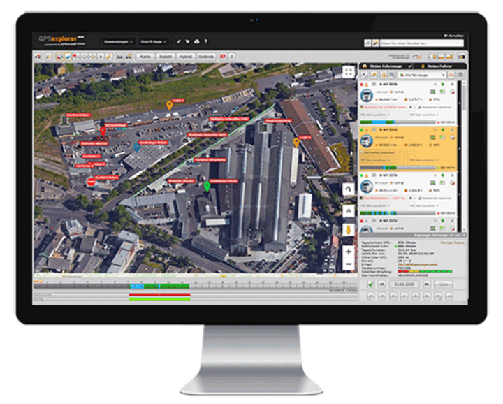
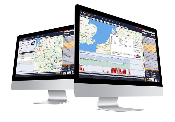

The associated telematics portal
The GPS Explorer (browser-based web portal) is included with every GPSaugen (telematics unit). It is a powerful application for managing fleets of any size.
It doesn’t matter whether you need to manage just one vehicle or thousands.
Try it now with no obligation

Test the most professional telematics solution extensively, with no obligation and at no cost, and see for yourself why it’s the most powerful telematics system.
Simply provide your contact information, and your account manager will assist you from product selection to installation in your vehicle—he’ll take care of everything and be available to answer any questions you may have throughout the entire trial period.
- Free Trial
- based on your requirements
- tailored to your company’s structure
- Your personal account manager will guide you through the process
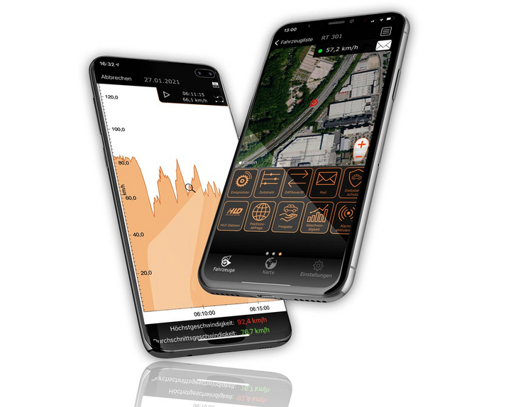

Everything at a glance—even on the go
Manage your fleet with GPS-Explorer Mobile: fleet management even when you're on the go.
Which vehicle in your fleet is closest to a destination address?
Where are my vehicles?
What is the current temperature in the cargo area?