
Always stay up to date!
The GPSoverIP newsletter keeps you up to date on the latest in telematics:
Whether it’s new products, new features, or upcoming events, you’ll receive our news via email.
The newsletter is published several times a year, depending on current topics.
Newsletter-Archiv
GPSoverIP Newsletter 07/2025
GPSoverIP Newsletter 07/2025 – Stay Up to Date
What’s new at GPSoverIP? Quite a lot: The 2G shutdown is getting closer. We’ll show you what this means for your telematics and how to make the switch in time. Also in this newsletter: new features in GPS Explorer, app updates, integration tools for your ERP system, a smart solution for documentation in public transit—and several awards for us.
Plus, exciting industry topics like the launch of the BALM funding program. In short: Anyone who works with GPSoverIP is well-informed and prepared.
Check it out now and stay up to date!
Important Information About the Grant Program – The Clock Is Ticking!
"Environmental Protection and Safety" Funding Program 2025: Take Action Now!
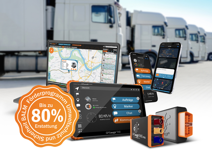
The countdown is on: Government funding for telematics solutions begins on August 4, 2025, at 9 a.m.
The Federal Office for Logistics and Mobility (BALM) has announced the official start date—so now is the time to get ready and not waste any time.
The BALM’s “Environmental Protection and Safety” funding program supports companies in digitizing and equipping their fleets with telematics—GPS-over-IP solutions are also eligible for funding.
What does this mean for companies?
Anyone who wants to digitize their fleet or equip it with telematics solutions should take action now. Because once the application portal goes live, every minute counts—experience shows that funding is quickly exhausted.
Application period: August 4, 2025 – September 1, 2025
. Applications will no longer be accepted after September 1!
What is eligible for funding?
Telematics systems such as our GPSauge solutions are among the eligible measures. These include, among others:
- Vehicle tracking and fleet management systems
- Solutions to improve traffic safety
- Digital logbooks and driver applications
- Sensors for fuel consumption and emissions analysis
For more information, visit stage.GPSauge.de or pressebox.de
Ready for funding?
Secure your chance at government funding for telematics solutions now. We’ll help you get ready:
- Eligible Products
- Technical documentation for the application
- Personal consultation
Contact
us now at vertrieb@gpsoverip.de
or+49 (0)9721 - 79 69 73-40
2G/3G Shutdown Affects Millions of Telematics Devices – GPSoverIP Calls for Upgrades

2G/3G Shutdown Affects Millions of Telematics Devices – GPSoverIP Calls for Upgrades
No network, no signal: Older devices will lose connection starting in 2028. GPSoverIP offers upgrade solutions.
By 2028 at the latest, the 2G cellular network in Germany will also be shut down. Following the already completed 3G phase-out, this marks the next major change for connected systems. What has long ceased to be an issue for smartphones now poses challenges for fleet operators and telematics users. Devices with outdated 2G or 3G technology will literally lose their connection—and with it, their full functionality.
“By July 2028 at the latest, the situation will become critical for many telematics solutions using older devices,” says Dirk Jurleit of GPSoverIP. “Without a cellular network, real-time tracking, data collection, and remote access will no longer work—and with that, key fleet management functions will be lost.”
GPS trackers, location devices, and older telematics units without LTE or 5G support will be particularly affected. After the shutdown, they will either go completely offline or operate with severely limited performance.
Telematics solutions from GPSoverIP, such as the GPSauge MI6 or the GPSauge OBD, are already 4G/5G-ready today. Customers who are still using older generations of devices will be actively informed and provided with technical and organizational support during the transition. GPSoverIP recommends switching to modern hardware in a timely manner, not only to ensure functionality but also to benefit from new capabilities such as HD tracking or driving behavior analysis.
“Those who upgrade now not only ensure the operational readiness of their fleet but also invest in future-proofing and digital efficiency, while reducing long-term maintenance and operating costs,” said Jurleit.
Further information on the upgrade, the buyback program, and special terms for existing customers is available directly from GPSoverIP.
Please also take note of our current promotion!
Our special prices for telematics solutions—the GPSauge OBD plug-and-play system, the GPSauge MI6 with comprehensive vehicle and telemetry data, and the GPSauge TAB driver tablet—are available through July 31. Find out more and take advantage now!
Smart Tacho 2 Is Becoming Mandatory—Upgrade Now!
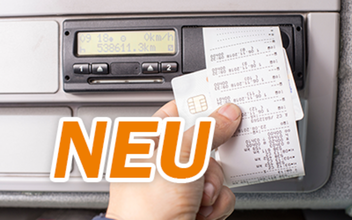
Mandatory Starting in 2025: Smart Tacho 2 for Cross-Border Transport
New EU regulations are changing the use of tachographs and telematics systems
Effective August 19, 2025, anyone engaged in cross-border transport within the EU must use the second-generation smart tachograph (Smart Tacho 2, Gen2V2) in vehicles weighing over 3.5 metric tons. With this move, the EU is making a clear break as part of theMobility Package—with direct implications for the entire telematics market.
What does this mean right now?
- Vehicles equipped with the previous Smart Tacho 1 (e.g., DTCO 4.0) must be retrofitted to Smart Tacho 2 (e.g., DTCO 4.1) by August 19, 2025, at the latest. Thisapplies only to vehicles engaged in cross-border transport.
- Vehicles equipped with analog or older digital devices (pre-2019) were already required to be retrofitted by December 31, 2024.
- Starting July 1, 2026, the tachograph requirement will apply for the first time to light commercial vehicles weighing 2.5 metric tons or more, provided they are used in international transport.
Why these regulations?
The EU’s goal is to better monitor driving and rest times, prevent tampering, and facilitate the enforcement of posting and market regulations. The new Smart Tacho 2 offers more accurate GPS tracking and additional automatic monitoring functions.
Warning—Risk of Fines!
Anyone who ignores the deadlines risks heavy fines, up to and including having the vehicle takenoutofservice. There is a final transition period until February 2025 for older devices, but for vehicles equipped with Smart Tacho 1, the deadline is non-negotiable.
Our tip: Check now which vehicles are affected—and start planning your telematics solution right away. Many systems will need to be adapted to the new requirements or reintegrated.
Key Deadlines at a Glance
| Deadline | Affected Vehicles | Action |
|---|---|---|
| December 31, 2024 | Over 3.5 metric tons, analog/digital (pre-2019) | Retrofit to Smart Tacho 2 for cross-border transport |
| August 19, 2025 | Over 3.5 metric tons, Smart Tacho 1 (from 2019) | Retrofitting to Smart Tacho 2 for cross-border transport |
| July 1, 2026 | 2.5–3.5 metric tons, cross-border transport | First-time tachograph requirement with Smart Tacho 2 |
A new update for the GPSauge mobile app on the GPSauge TAB!
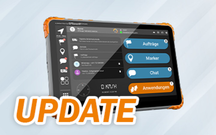
GPSauge TAB: New Update for the GPSauge Mobile App—Better Performance, a Clearer Overview, and Detailed Driving Data
With the latest update to our GPSauge mobile app, we’ve rolled out several improvements: We’ve fixed minor bugs and optimized technical performance, making the app run even more stably and smoothly overall. This applies to both use on the GPSauge TAB and the standalone version on your smartphone. Structural adjustments have also been made to the backend, making the app future-proof and even more reliable.
Furthermore, the driving style analysis and driver evaluation have been comprehensively revised.
Telematics data is now analyzed with even greater precision and detail—a real added value for drivers and fleet managers.
Among other things, the following are recorded:
- Acceleration and braking behavior
- Speed and compliance with speed limits
- Use of cruise control and periods of idling
The app presents this data in an easy-to-understand format and provides specific tips on how to improve driving behavior—with the goal of driving more economically, safely, and sustainably.
Why this is important:
- Less wear and tear, lower fuel consumption
- Greater road safety
- Motivation to improve through transparency
- Support for sustainability goals in the fleet
A heartfelt thank you to everyone who helps us continuously improve the app through their feedback on the App Store or via support. We always welcome your suggestions!
Do you have questions?
Our support team is happy to help: support@GPSoverIP.de
Install the update now and get started right away!
GPS Explorer Update: Many Improvements—and Now New: Track Predictive Route Navigation in Real Time with MapTrip
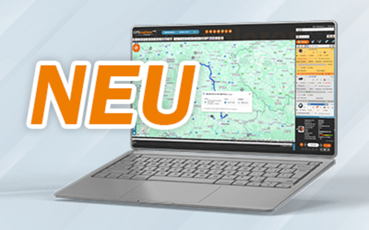
GPS Explorer Update: Real-Time Route Intelligence with MapTrip—and Looking Ahead
As part of our continuous improvement process, we’re constantly implementing numerous backend technical improvements and functional optimizations in GPS Explorer; many of these were already presented in the last update report.
For anyone who hasn’t read the report yet:Click here to read it.
A new addition is the route preview, a real highlight for anyone who works with GPSauge TAB and MapTrip.
More Than Just Live Tracking: Now with Route Preview
Anyone who coordinates fleets needs more than just a vehicle’s current location. With the new interface to the professional navigation system MapTrip, GPSoverIP is taking a major step forward: Instead of just live tracking, you can now see the route preview—the actual route to be driven and the remaining distance to the destination—directly in GPS Explorer. This feature takes live traffic data, remaining driving times, and break times into account. That means you’re not just tracking the live position, but the entire route—from start to finish, always up-to-date and looking ahead!
This is especially exciting for anyone who already uses MapTrip or is looking for professional navigation with vehicle profiles—whether you’re a courier service, a trucking company, or a municipal fleet.
Your new features at a glance
- View planned routes (route preview): After entering a destination in the navigation system, MapTrip displays the complete planned route, including waypoints. We automatically transfer this route back to GPS-Explorer.
- Monitor actual routes driven: While driving, you can see the actual route driven in real time—including any deviations from the planned route. This lets you immediately see if everything is going according to plan.
- Check remaining distances: Dispatchers can immediately see how many kilometers are left and which section of the route is next—for precise scheduling.
This route preview is fully integrated with your existing MapTrip navigation on the GPSauge TAB. This means: Data is transmitted directly from the GPSauge TAB in the vehicle to your GPS-Explorer via MapTrip. You don’t need any extra tools and no longer have to manually reconcile anything—everything is in one place. You can view this information in the GPS-Explorer without any additional software. This not only provides a clearer overview but also improves your processes and communication—both internally and externally.
This new feature delivers real added value
- No system switch: Everything is visible in the GPS-Explorer web portal; no need to switch to third-party systems
- Looking ahead instead of looking back: Live planning and ETA instead of just location data
- Better overview: Planning, deviations, remaining distance—all at a glance, for informed decisions.
- Dispatch can intervene in real time, for example, in the case of last-minute orders, time pressure, or detours. You can respond flexibly to unforeseen events.
- Identify deviations immediately, without time-consuming follow-up inquiries.
- Make supply chains more transparent; processes can be better planned and coordinated.
- Improved customer communication and accurate arrival times through ETA tracking increase customer satisfaction.
- Generate more informed analyses; planned and actual routes are traceable and form the basis for optimizations
Requirements
- GPSauge TAB installed in the vehicle
- Active MAPTrip license with vehicle profile (e.g., truck mode)
The route data comes directly from the GPSauge TAB in the vehicle, on which the MapTrip navigation is actively running. This information is automatically transferred to the GPS Explorer.
Who is this for?
These features are ideal for:
- Dispatchers and logistics professionals who need to respond flexibly to route changes.
- Fleet supervisors and fleet managers who need real-time visibility into planned and driven routes
Companies that regularly transport goods—whether by car, van, or truck—and prioritize precise planning and control.
Conclusion
With the MapTrip integration in GPS-Explorer, you can see not only where your vehicles are, but also where they’re going. This is a real difference from traditional tracking and a clear advantage for your dispatch operations.
Info Box: MapTrip Navigation by infoware
Manufacturer: infoware GmbH, Bonn Product: MapTrip – Professional Navigation for Transportation and Logistics Type: Vehicle-specific navigation with online connectivity Special Features - Truck profiles take height, weight, and hazardous materials into account. - Real-time traffic information and dynamic route guidance. - Reference route monitoring: Dispatch specifies the route—the driver stays on track. - Display of alternatives: fast, shortest, cheapest. - Special modes: passenger cars, vans, trucks, special vehicles, emergency vehicles. - Live traffic data, roadwork, and traffic jams. - Dynamic route adjustment. - Speed limits, speed camera & hazard alerts. - Toll calculator & parking spot finder. - POI search (gas stations, parking lots, hotels, etc.). |
Integrate the GPSoverIP platform into your ERP/CRM system—it couldn't be easier.
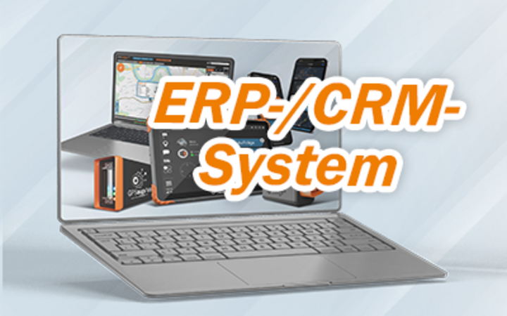
Integrate Instead of Improvising—with GPSoverIP
Would you like to import location data, telemetry, odometer readings, or the order status of your vehicle fleet directly into your ERP, CRM, or logistics system?
Then you don’t need any additional software—you need GPSoverIP.
With GPSoverIP, your telematics data flows exactly where it belongs: directly into your existing IT infrastructure. No detours, no data format changes—and all in real time.
Your benefits at a glance:
- Interfaces are free of charge and thoroughly documented
- Validated standards for a quick start
- No new software required—you work with your familiar system
- Bidirectional data exchange possible (e.g., sending orders)
- Active developer forum for peer-to-peer support
Three smart ways to integrate:
- API interfaces—REST-based, with sample code for Java, PHP, Python, C#, and many more.
stage.gpsauge.de/anbindung/api - High-Level Driver (HLD)—Communication via file exchange, ideal for batch processing
stage.gpsauge.de/anbindung/hld - Web modules via iFrame – Easy integration of individual functions into any HTML interface
stage.gpsauge.de/anbindung
Any questions?
Our developer support is here to help:
support@gpsoverip.de
+49 (0) 9721 / 79 69 73 – 50
Changes to the Geocoding API: Act Now and Save!
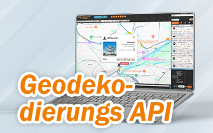
Important Change to the Geocoding API—Get Ready Now!
This will take effect in 2026: Anyone who does not provide geocoordinates will automatically use the new, fee-based AI API.
Recommendation: Provide coordinates directly to the system or use structured address data (free of charge).
Action required by December 31, 2025!
At the end of the year, geocoding via our GPSoverIP API will be restructured. If, for example, you have integrated ERP systems and transfer order data to end devices, you should—if possible—provide exact geocoordinates (longitude and latitude) directly. This completely eliminates the need for address resolution—it’s fast, direct, and at no additional cost.
For all other cases, we will offer two new API variants starting in 2026:
- Structured Address API (free of charge): This requires a clean, standards-compliant address structure (e.g., street, ZIP code, city in separate fields).
- AI-powered Address API (fee-based): This API detects unstructured or incorrect address information through intelligent analysis—however, it is subject to a fee and depends on usage volume.
Important: Starting January 1, 2026, the fee-based AI version will be used automatically unless you have switched to the alternative. Our recommendation: Switch to submitting coordinates or structured address data as soon as possible!
If you have any questions or need technical assistance, our support team is happy to help:
support@gpsoverip.de
+49 (0) 9721 / 79 69 73 – 50
When it gets hot, every degree counts.
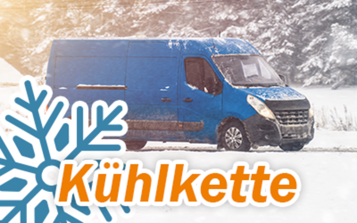
Cold Chain Under Control—Even at 35°C in the Shade
Temperature Monitoring with Telematics
Summer is here—and with it come not only rising outdoor temperatures but also increased demands on the transport of temperature-sensitive goods. Breaches in the cold chain can quickly become costly. Whether it’s fresh food, frozen goods, or medications: for many products, maintaining an unbroken cold chain is crucial for quality, safety, and compliance with legal requirements.
With our GPSauge telematics systems, transportation companies can keep a close eye on the temperature inside the vehicle at all times—in real time.
How does it work?
- Continuous temperature monitoring: Sensors in the cargo area continuously measure the temperature.
- Real-time transmission: The readings are transmitted wirelessly to a GPSauge device in the vehicle.
- Centralized Analysis: All data is consolidated in the GPS-Explorer web portal—live, accessible at any time, and ready for analysis.
- Instant Alerts: You’ll be notified immediately if temperature limits are exceeded.
- And of course: All data is automatically documented, providing a complete record for quality assurance, customer requirements, or regulatory compliance.
Real-World Insight: Flexible, scalable, ready to use
“What many people don’t know: Even with our compact plug-and-play solution, the GPSauge OBD, professional temperature monitoring is very simple. The device is available, for example, on Amazon and is ready for immediate use.”
Temperature measurement is performed via Bluetooth sensors, known as BLE tags (Bluetooth Low Energy)—particularly the long-range version—which communicate with the GPSauge. These tags enable stable temperature monitoring even over longer distances. This is ideal when multiple measurement points in a trailer—at different levels or in separate compartments—need to be monitored.”
Anyone already using temperature loggers such as ORBCOMM Euroscan, Thermo King, or Schmitz Cargo Bull can also easily integrate them into our solution. Trailer data, such as EBS information, can also be integrated via the standardized interface. This means that, in addition to location and temperature, other vehicle data is also available—all centrally bundled into a single system.
Your benefit
- Stable cold chains
- Minimized risk of product spoilage
- Seamless traceability at the touch of a button
- Full control and rapid response in an emergency (dispatchers can intervene at any time if the situation becomes critical.)
Telematics not only ensures transparency—it also provides real confidence in decision-making.
Especially during peak season, when even the slightest deviation can be costly, digital temperature monitoring with GPSauge is a decisive advantage in day-to-day operations. Less risk, more control—and a clear view at all times of what’s really happening in the cargo compartment.
Curious?
We’d be happy to show you how temperature monitoring can be easily integrated into your fleet.
Digital Proof of Travel on Public Transportation: GPSauge Takes the Pressure Off Bus Companies

Requirements Met – Contracts Won: Why Digital Documentation Solutions Pay Off Twice for Bus Companies
Bus companies that use subcontractors in public transit are under increasing pressure: Legislators, public authorities, and contracting agencies are demanding complete, digital, and audit-proof documentation of service delivery—especially when working with subcontractors and for tenders. Those who still rely on paper or manual processes risk not only incurring unnecessary costs but also compromising their competitiveness and ability to win bids.
This is exactly where our telematics solution comes in: It automatically documents all relevant data—from trips and driving times to vehicle conditions and compliance with legal requirements such as minimum wage or driver’s license checks. The records are centrally collected, analyzed, and stored in an audit-proof manner—ideal for collaboration with subcontractors as well.
GPSauge reliably meets these requirements
- Automatic recording of trips, driving and rest times, and vehicle condition.
- Direct integration of subcontractor data—including driving times, driver’s licenses, and proof of minimum wage compliance.
- Real-time reporting for public transit authorities and contracting agencies.
- Exportable, standards-compliant reports for e-procurement and bid documents.
Your practical benefits:
- Efficiency: No more manual post-processing—all data is automatically recorded and processed digitally.
- Legal certainty: Tachograph data and real-time information are centrally archived and accessible at any time.
- Competitive advantage: In tenders, what counts is who can document all services transparently and completely.
- Transparency: Subcontractor services are clearly traceable both internally and externally.
This digital transparency gives you a real advantage in bidding processes. After all, those who can demonstrate that they consistently meet legal and quality requirements score points with clients—through trust, reliability, and efficiency.
Whether as proof of approval, a tender supplement, or an internal control tool—with our solution, you have all relevant data under control. And your clients can rest assured: they can count on you.
Manual documentation requirements vs. the GPSauge solution:
- Previous weakness: Many companies collect documentation manually—a process that’s often incomplete, time-consuming, and risky.
- Our solution: GPSauge fully automates this process and delivers streamlined, digital automation instead of mountains of paperwork.
Telematics Meets AI

Telematics Meets AI: GPSoverIP Unveils Concept for Smart Train Diagnostics
How can rail transport be made even more efficient and require less maintenance? GPSoverIP is thinking ahead—with a concept for a new, AI-powered data unit for condition monitoring and energy analysis.
VDV 238-compliant, with no need to modify existing systems—a smart plug-and-play approach for the maintenance of the future.
- Get a first look on July 25 in the annual magazine RegioTrans.
- A white paper is in the works.
More on this coming soon—stay tuned.
Nominated Again! GPSoverIP Among the Top 3 for the 2026 German Telematics Award

2026 German Telematics Award – GPSoverIP Nominated in Six Categories
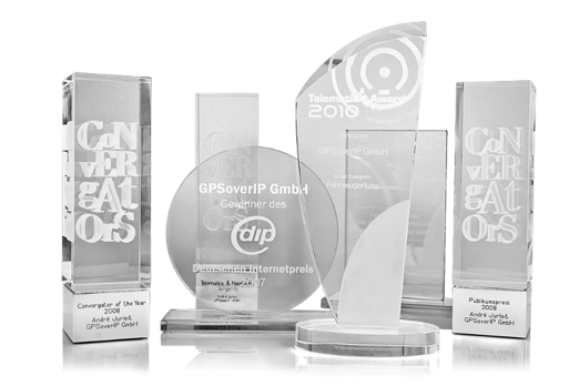
The German Telematics Award 2026 is moving into the next round—and GPSoverIP is once again among the nominees, in six categories no less. This makes the company one of the favorites with the broadest range of nominations in this competition organized by DEKRA and ETM-Verlag.
GPSoverIP has been nominated in the following categories:
- Asset Management
- Bus/Public Transit
- Driver Management
- Vehicle Technology
- Field Service (Passenger Cars/Vans)
- Special-Purpose Vehicles
This shows that GPSoverIP not only excels in traditional fleet solutions but also delivers impressive results in specialized areas, ranging from waste collection vehicles to public transit and field service fleets.
Now it’s time for the practical test
The preliminary selection was conducted by a panel of experts led by Prof. Dr. Heinz-Leo Dudek from the Steinbeis Transfer Center for Telematics. Following the written phase, the technical field test is now underway. Here, the systems must demonstrate how well they handle real-world logistics tasks—from setting up a geofence to integrating with a TMS. Among other things, the evaluation covers functionality, UX, click paths, and response times—a true endurance test.
Independently evaluated—by a panel of experts
The German Telematics Award stands for true objectivity and is not merely an industry award. The evaluation is conducted independently and in a manufacturer-neutral manner—a strong signal of quality and trustworthiness. The jury consists of experts from academia, industry, trade associations, and the trade press:
- Prof. Dr. Heinz-Leo Dudek, DHBW Ravensburg
- Martin Trümper, DEKRA
- Andreas Schmidt, BGL (Federal Association for Road Freight Transport, Logistics, and Waste Management)
- Carsten Nallinger, eurotransport.de / ETM Verlag
- Stephan Feitzelmayer, SF Telematik
- Johannes-Nikolaus Nießen, P3 Group
For more information and a list of all nominees, click here:
German Telematics Award 2026 – eurotransport.de
Our Streak of Success at the German Telematics Award
We look back with pride on our consistent success at the German Telematics Award. Since 2016, we have been honored multiple times in a row across various categories. The award is considered one of the most rigorous and realistic tests in the industry. Especially in a competitive environment where many providers are vying for attention, we are all the more pleased that our work has been recognized at a consistently high level over the years.
These repeated awards underscore our sustained innovative strength and our commitment to developing the best solutions that truly work in practice.
clickApoint—GPSoverIP's freight exchange—named Best Online Portal of 2025
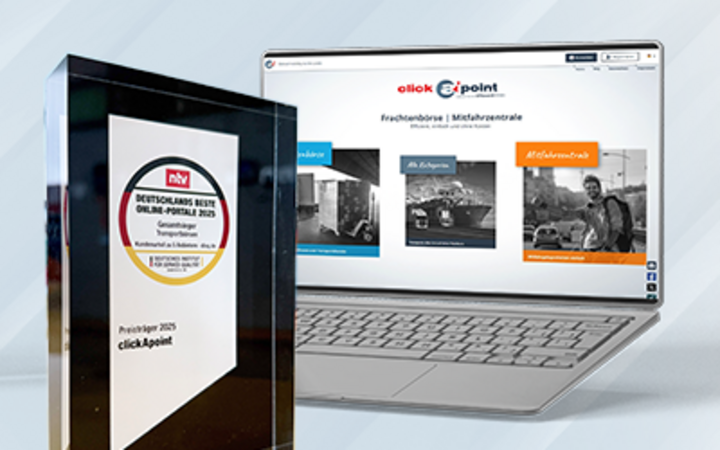
clickApoint—GPSoverIP’s Freight Exchange—Named Best Online Portal of 2025
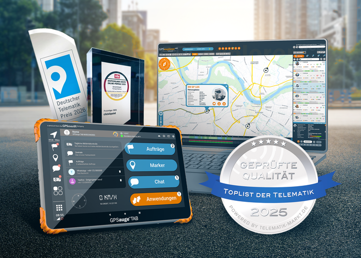
A major success for GPSoverIP GmbH: The company’s in-house freight exchange, clickApoint, has been honored for the third consecutive year with the prestigious “Germany’s Best Online Portals” seal as the overall winner in the freight exchange category.
We are on the TOPlist of telematics providers for 2025

Recognition as a Member of the TOPLIST Telematics 2025
We are pleased to announce that we have once again been included in the “TOPLIST of Telematics” for 2025.
Inclusion in this exclusive list is a significant milestone and confirms our ongoing commitment to quality, innovation, and customer satisfaction in the field of telematics. The “TOPLIST of Telematics” is an editorially managed network organized by the industry portal Telematik-Markt.de. Only providers who undergo a rigorous annual review by an independent panel of experts are included in this list. The evaluation focuses on technology, service, and support. Only those who excel in all areas receive the coveted seal.
What’s behind the TOPLIST seal?
It is not a traditional competition award, but rather a recognized mark of quality for companies that offer telematics solutions at the highest level. Regular reviews by independent experts ensure that products and services remain up-to-date and competitive. Especially in a dynamic market environment where technological possibilities and customer requirements are constantly evolving, this seal serves as an important guide for users and decision-makers.
“The qualified members of the ‘TOPLIST of Telematics’ set themselves apart from the competition in terms of quality with their products, having successfully passed the evaluation. Competitiveness thus represents a decisive advantage for both sides—because the sheer number of providers often obscures the view of quality.”
Looking Ahead
We thank all our employees, partners, and customers for their trust and cooperation. This award serves as both an incentive and a commitment for us to continue developing innovative, reliable, and future-proof telematics solutions.
Your GPSoverIP Team
New in GPS Explorer: Volvo Connect Integrated

New in GPS-Explorer: Volvo Connect Integrated
Our telematics portal, GPS-Explorer, now supports Volvo Connect!
This allows you to connect Volvo Trucks directly—regardless of the manufacturer—and manage them centrally on a single platform. In addition to standard vehicle data, you now also have access to E-Power data from electric trucks and electric vehicles, such as state of charge, energy consumption, and range.
This is ideal for efficiently managing your electric fleet and keeping track of everything.